 |
|---|
1750 Common Land This is a map showing the common land in South East Monmouthshire 1750-1850. The contour interval is 25 feet. | 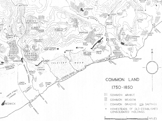 |
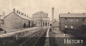
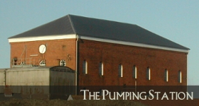 Built to pump water from the Severn Tunnel after a 'great spring' was discovered, it's been in action since 1886... |
| Beach | Black Rock | Chapel | Cricket | Documents | Fishing |
| Genealogy | Hillfort | Housing | Map | News | Paper Mill |
| Pumping Station | Rail | River Severn | Severn Bridge | Severn Tunnel | Ship Building |
| St Marys | Tides |
| Sudbrook.Info ? MMXXII | Vergence Web Design |